


Garmin Montana® 710 Rugged GPS Touchscreen Navigator - Bundle
Garmin Montana® 710 Bundle with Free Accessories
Get the Garmin Montana® 710 with extra accessories included FREE, making it easier to power and protect your device at home, on the road and in the wild.
Free accessories included
-
- ✓ Screen Protector
- ✓ Wall Adapter
- ✓ Car Adapter
- ✓ Garmin charging/data cable
About this item
-
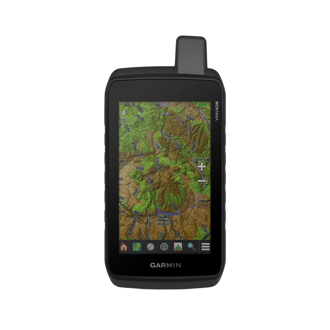
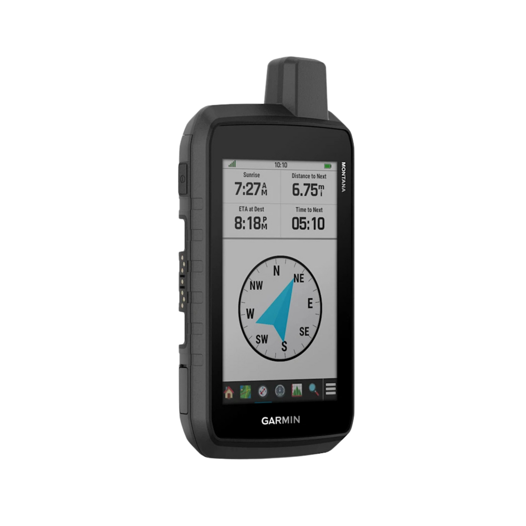
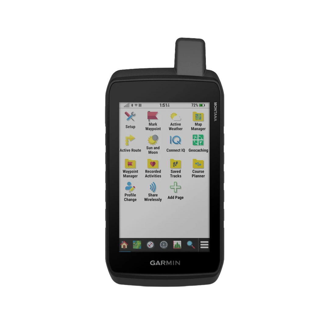
Large 5-inch glove-friendly touchscreen
-
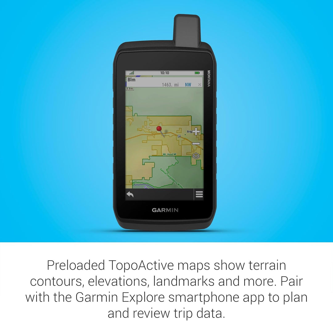
Preloaded topographic maps with landmarks
-
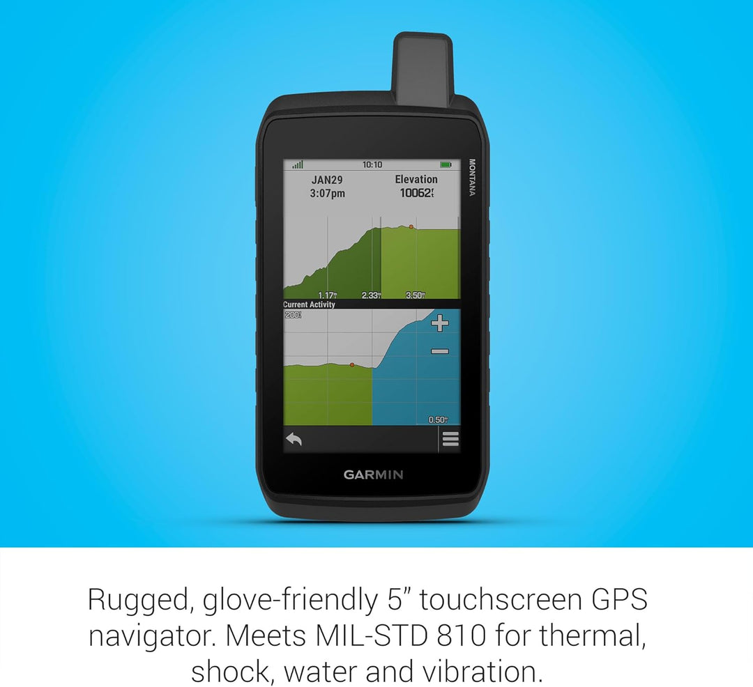
Meets MIL-STD 810 for thermal, shock, water, and vibration
-
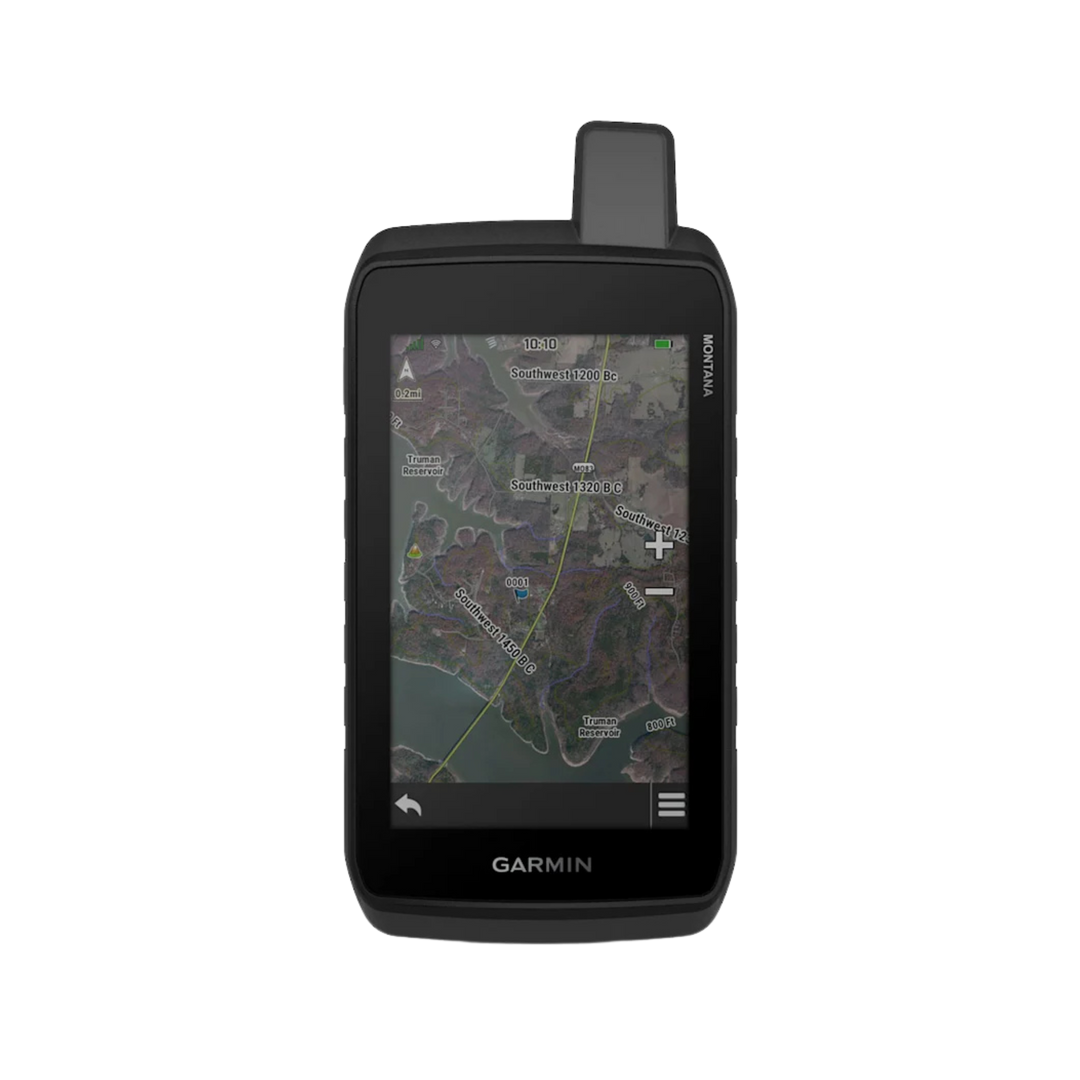
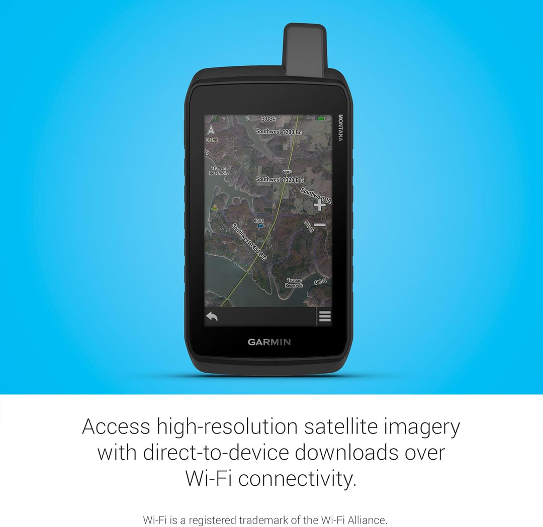
Satellite imagery shows vivid overhead views of your route
-
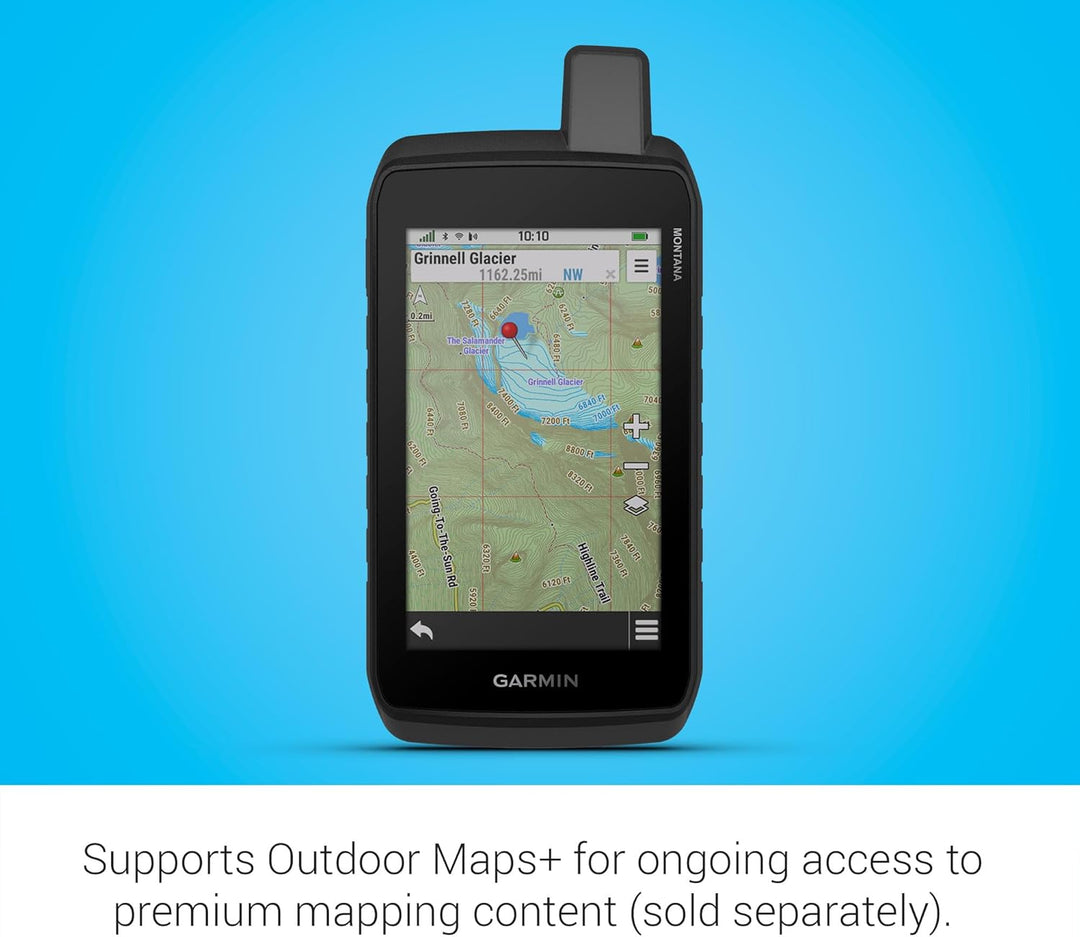
Supports Outdoor Maps+ for premium mapping (sold separately)
Product Description
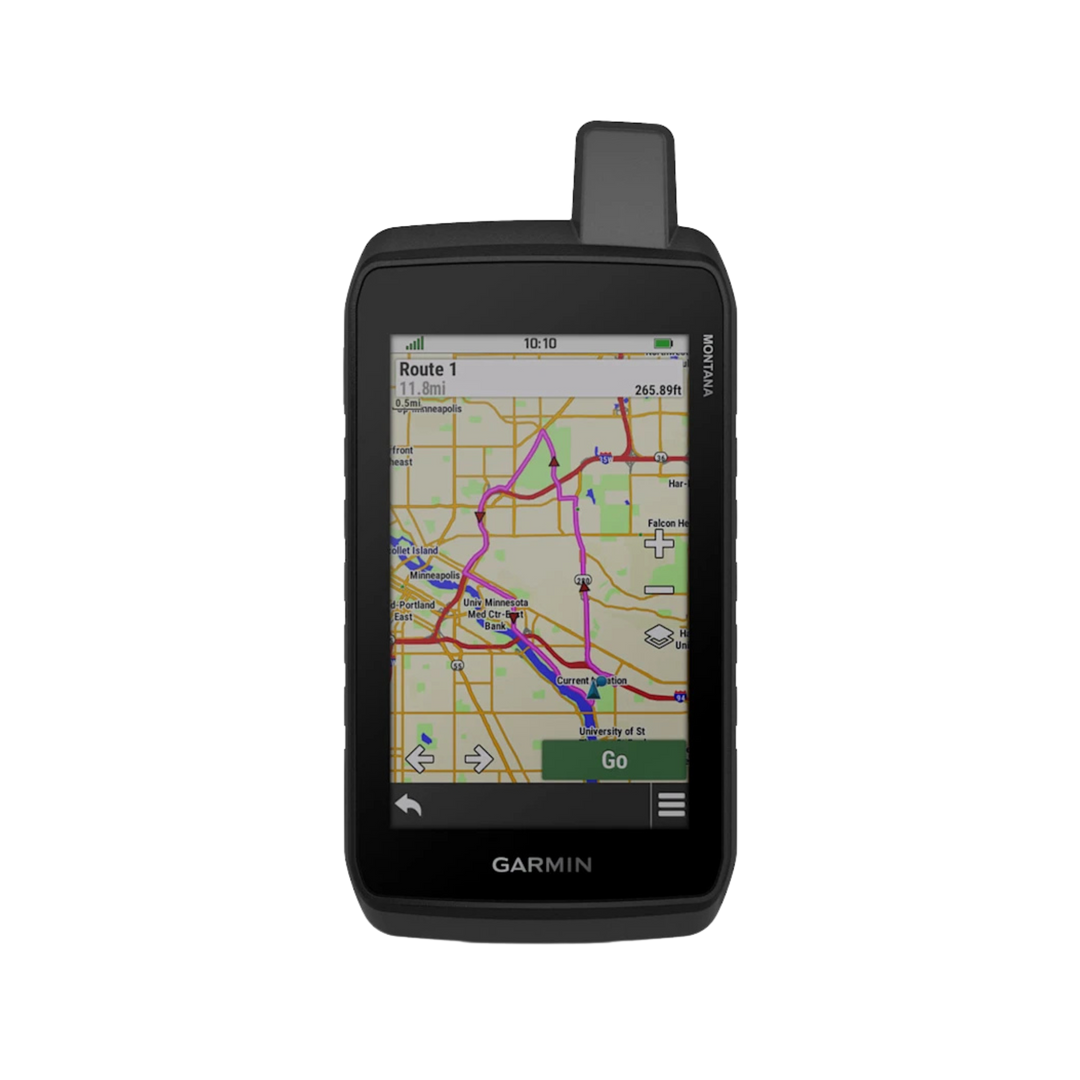
Navigate with confidence using the Montana® 710 handheld GPS. With TopoActive mapping and a 5” color touchscreen, it's perfect for any adventure. Store more maps with its 32 GB memory capacity and access high-resolution satellite imagery via Wi-Fi®. The device also supports multi-GNSS and has ABC sensors for both on-road and off-road use. For premium mapping content, add Outdoor Maps+ (sold separately). Enjoy up to 24 hours of battery life and a durable design that meets MIL-STD 810 and IPX7 standards.
WHAT YOU'LL LOVE

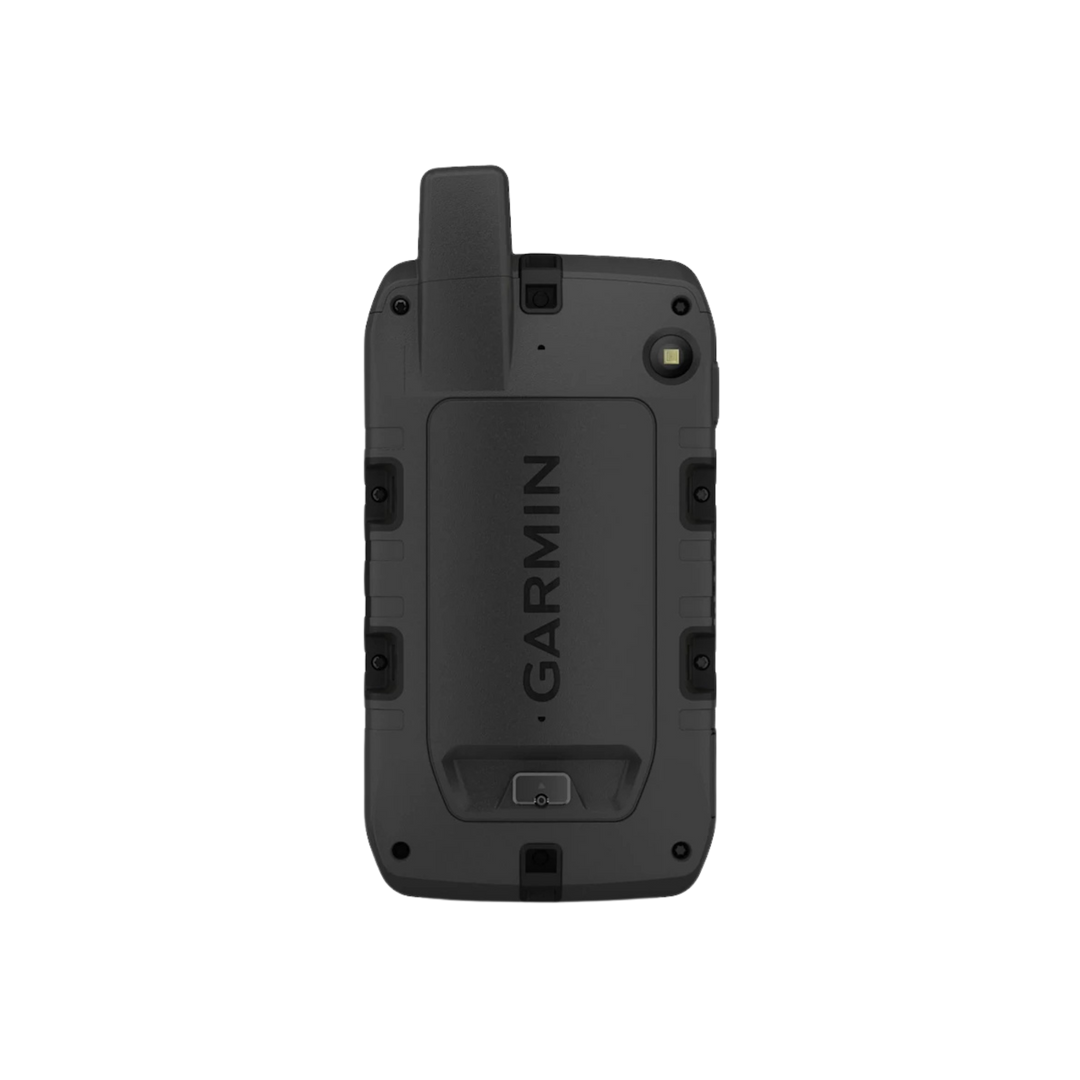
RUGGED BY DESIGN
This durable, water-resistant handheld is tested to meet MIL-STD 810 for thermal, shock, water and vibration. It features a glove-friendly 5-inch touchscreen and is compatible with a variety of robust mounting solutions (sold separately) to best suit your activities.

TOPOACTIVE MAPS
To navigate your adventures, use preloaded worldwide topographical maps. View terrain contours, elevations, coastlines, rivers, landmarks and more.

SATELLITE VIEWS
Access subscription-free, high-resolution satellite imagery with direct-to-device downloads over Wi-Fi® connectivity. See photorealistic overhead views of routes and surrounding terrain, and easily create waypoints based on landmarks.

ADDITIONAL MAPS
With 32 GB of onboard memory, you can download even more maps, such as City Navigator® maps for your drive or BlueChart® g3 charts for the water (sold separately).

OUTDOOR MAPS+
With a subscription to Outdoor Maps+ (sold separately), get ongoing access to a wide variety of premium mapping content and regular updates sent right to your Garmin device via Wi-Fi technology.

GARMIN EXPLORE APP
Pair with the Garmin Explore app to plan and review trip data, plus manage your waypoints, courses and activities.
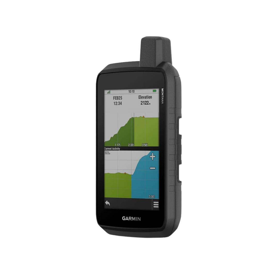
TRACK YOUR ADVENTURES ON ANY TERRAIN
In the Box
- Montana 710
- Lithium-ion battery pack
- USB cable
- Documentation
- 2x Silicone Cases
- Screen Protector
- Wall Charger
- Car Charger
Case colors may vary.
The Garmin Montana® 710 — Built for the Most Demanding Adventures
The Garmin Montana® 710 is Garmin's flagship rugged handheld GPS navigator, combining a massive glove-friendly touchscreen with military-grade durability and comprehensive navigation features. Whether you're leading off-road expeditions, navigating remote wilderness, or operating in challenging outdoor environments, the Montana® 710 delivers the performance and reliability you need.
Giant 5-Inch Glove-Friendly Touchscreen
The large 5-inch sunlight-readable display sets the Montana® 710 apart from every other handheld GPS. The responsive touchscreen works even with gloves on, making it ideal for cold-weather adventurers, hunters, and off-road drivers who need to navigate without removing their gloves. View detailed maps, routes, and waypoints with ease on the roomy display.
Preloaded Topographic Maps & Landmarks
The Montana® 710 comes preloaded with detailed topographic maps covering the United States, giving you immediate access to trails, terrain contours, roads, and points of interest. The microSD card slot lets you expand map coverage with additional Garmin maps including BirdsEye satellite imagery, hunting/fishing maps, and ski resort maps.
Multi-GNSS Navigation
GPS, GLONASS, and Galileo satellite reception provides rapid, accurate positioning across diverse environments. Multi-band technology on compatible modes ensures reliable accuracy even in dense forests, canyons, and urban environments where satellite signals can be blocked.
Military-Grade Durability
The Montana® 710 meets MIL-STD-810 testing for shock, vibration, and temperature extremes, and is rated IPX7 waterproof. The rugged rubber-armored housing protects it from drops, impacts, and exposure to the elements — rain, mud, dust, or snow won't slow it down.
Wireless Connectivity & Compatibility
Built-in Wi-Fi and Bluetooth connectivity let you wirelessly sync maps, waypoints, and routes with other compatible Garmin devices and the Garmin Explore™ app. Connect to your smartphone for live weather updates, smart notifications, and easy data sharing. ANT+® compatibility enables connection to additional sensors.
Camera (750i Model)
Select variants include an integrated camera for capturing photos and geotagging them directly to your map — so every photo is automatically linked to its location for easy reference and sharing.
Key Specifications
- Display: 5-inch sunlight-readable touchscreen (glove-friendly)
- Satellite systems: GPS, GLONASS, Galileo
- Waterproof: IPX7 | MIL-STD-810 tested
- Preloaded: Topographic maps with roads, trails, and landmarks
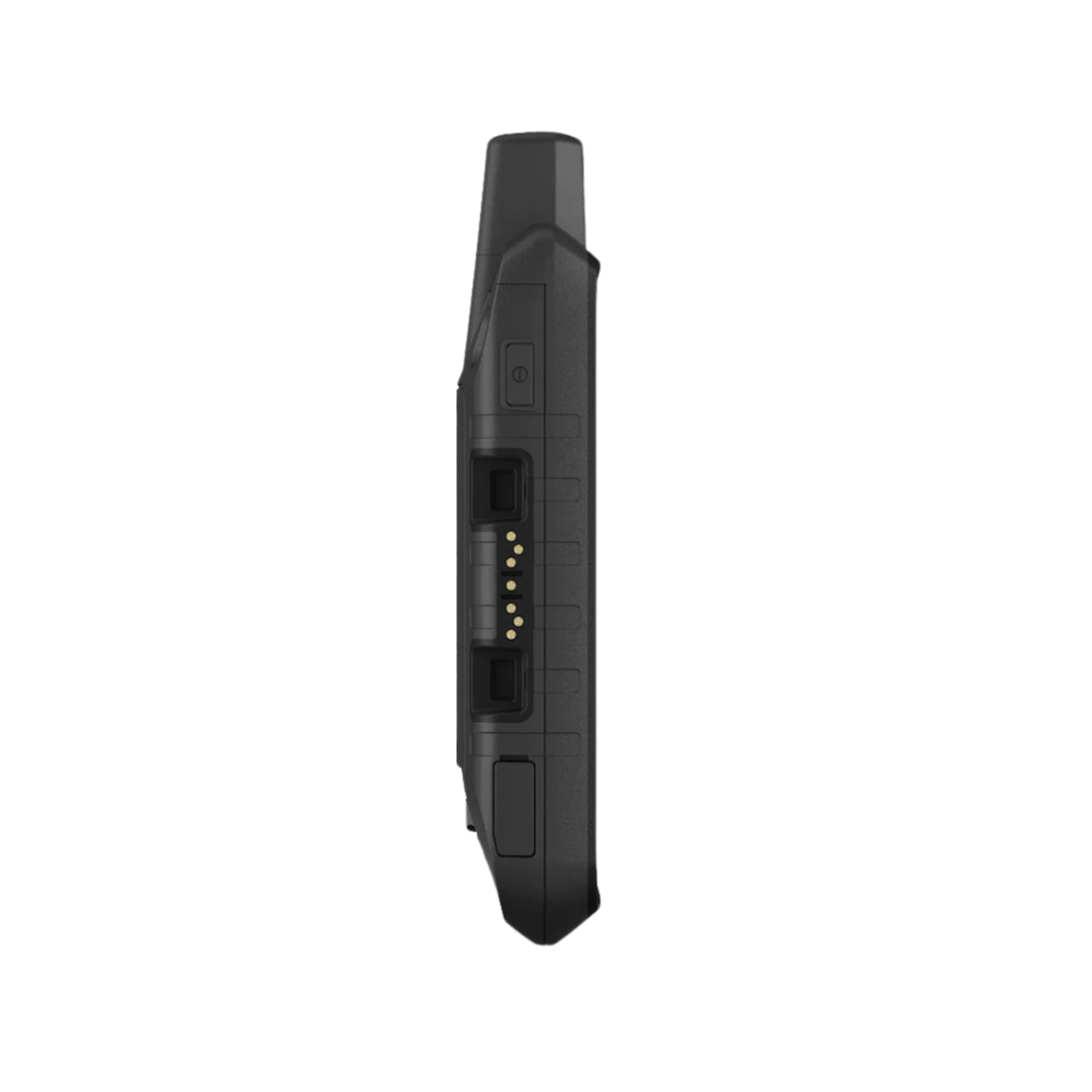
- Expandable memory: microSD card slot
- Connectivity: Wi-Fi, Bluetooth, ANT+
- 3-axis compass + barometric altimeter
- Battery: Lithium-ion rechargeable (or 3 AA batteries)
Freedom USA Sales is an authorized Garmin dealer. Purchase with confidence — full manufacturer warranty included with fast U.S. shipping.