Included Free
Garmin eTrex® 32x Ultimate Bundle with Free Accessories
Get the Garmin eTrex® 32x with extra accessories included FREE, making it easier to power and protect your device at home, on the road and in the wild.
Free accessories included
-
✓ 20pc Survival Kit
-
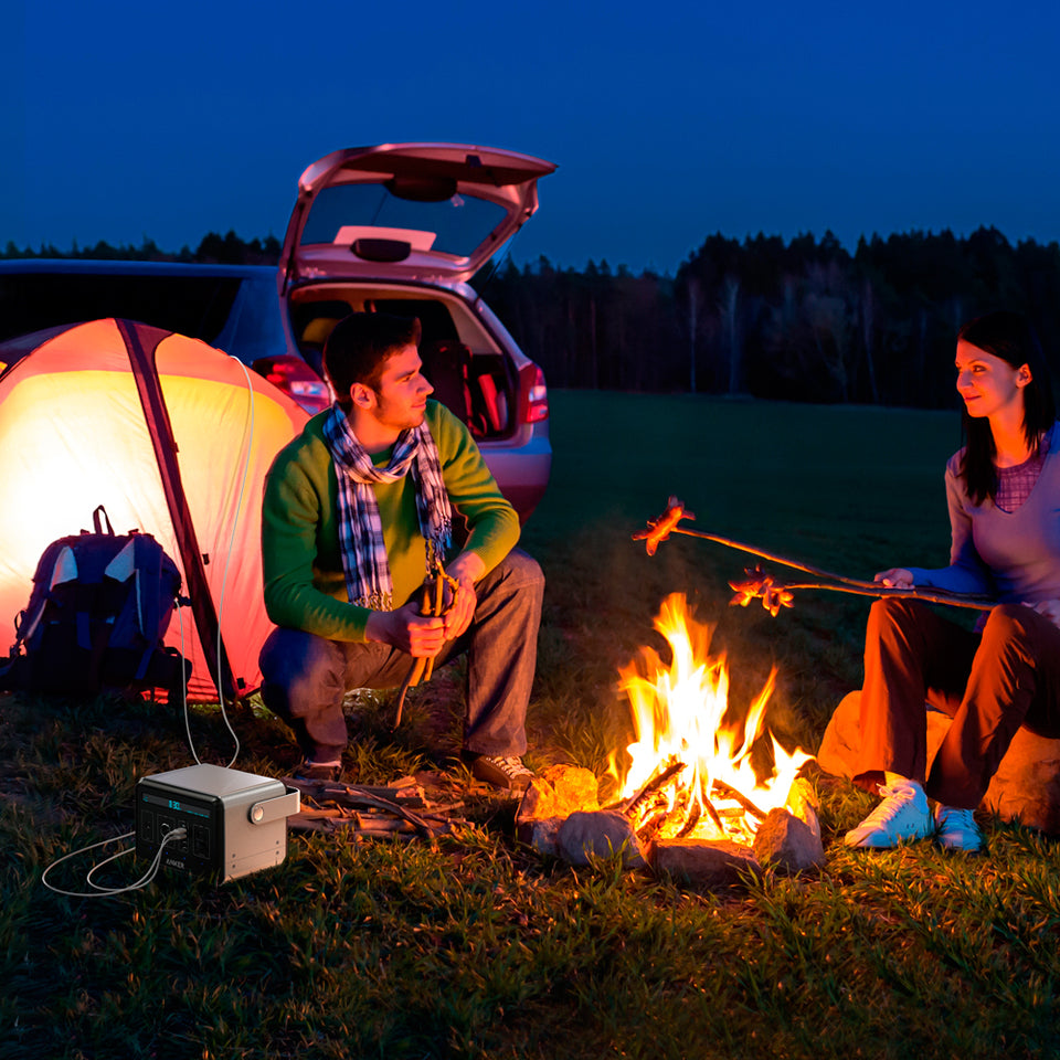
✓ Solar Powered Portable Charger
-
✓ 2x Silicone Protective Cases
-
✓ Wall Adapter
-
✓ Car Adapter
-
✓ Charging/Data Cable
-
✓ Carabiner Clip
-
✓ Screen Protector
Key Features
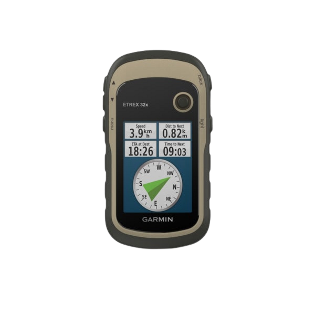
- 2.2” sunlight-readable color display with 240 x 320 display pixels for improved readability
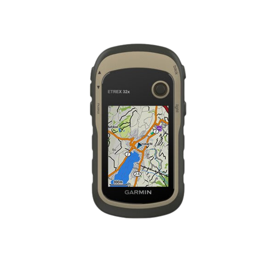
- Preloaded with TopoActive maps with routable roads and trails for cycling and hiking
- Compass and Barometric Altimeter
- Support for GPS and GLONASS satellite systems allows for tracking in more challenging environments than GPS alone
- 8 GB of internal memory plus a microSD™ card slot
- eTrex 32x adds a 3-axis compass and barometric altimeter
- Battery life: up to 25 hours in GPS mode with 2 AA batteries
- Paperless Geocaching Software
- IPX7-Rated, Submersible to 3.3'
About the Garmin eTrex® 32x
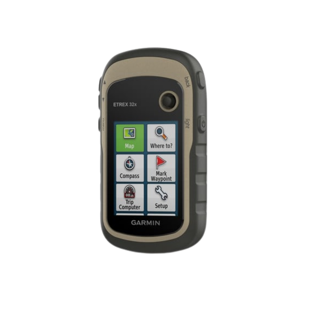
The Garmin eTrex® 32x is a compact, rugged handheld GPS navigator built for outdoor adventurers who need reliable navigation in the field. Whether you're hiking, geocaching, hunting, or exploring backcountry trails, the eTrex® 32x provides accurate GPS/GLONASS positioning in a durable, waterproof package that fits in your pocket.
Precision Multi-GNSS Navigation
The eTrex® 32x uses both GPS and GLONASS satellites to track your position faster and more accurately than GPS alone — especially useful in challenging environments like dense forests, steep valleys, and areas with obstructed sky view. With a high-sensitivity receiver, it maintains a strong signal lock even under heavy tree cover or in urban canyons.
Built-In Topographic Maps
Unlike basic GPS units, the eTrex® 32x comes preloaded with a basemap, and its microSD card slot allows you to add detailed topographic maps, BirdsEye satellite imagery, or custom maps from Garmin. The 2.2-inch sunlight-readable display makes it easy to view maps and navigation data in bright outdoor conditions.
Durable & Waterproof Design
Built to IPX7 waterproof standards, the eTrex® 32x can withstand rain, splashes, and immersion up to 1 meter for up to 30 minutes. The rubber-armored exterior protects it from drops and impacts, while the ergonomic design ensures a secure, comfortable grip even with gloves on.
Long Battery Life for Extended Trips
The eTrex® 32x runs on 2 standard AA batteries, providing up to 25 hours of battery life in GPS mode. AA batteries are available anywhere worldwide — no proprietary rechargeable pack to worry about dying in the backcountry. Keep a spare set in your pack and you'll never be without navigation.
Navigate, Track & Explore
Store up to 2,000 waypoints with name and symbol, 200 routes, and up to 200 hours of tracklog history. Use the track navigation feature to follow recorded trails back to your starting point (TracBack®), or share routes and tracks with other compatible Garmin devices via the microSD card or USB connection.
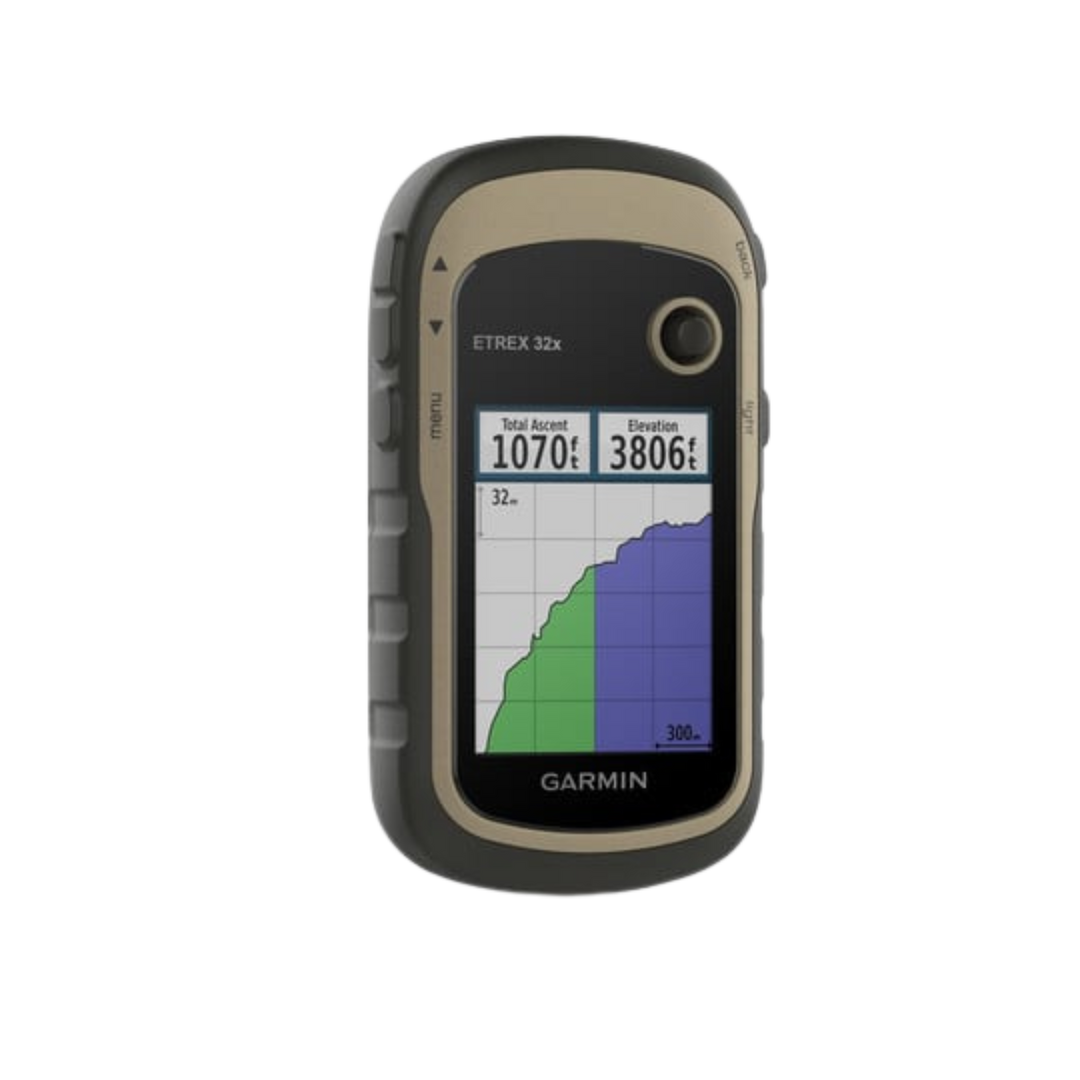
Compass & Barometric Altimeter
A 3-axis tilt-compensated compass provides accurate heading even when the unit is not held level, so you can check your bearing at any angle. The barometric altimeter gives precise elevation readings and can track pressure changes over time to help predict weather trends in the field.
Key Specifications
- Display: 2.2" sunlight-readable color display, 240 x 320 pixels
- Satellite systems: GPS + GLONASS
- Waterproof: IPX7 (1 meter for 30 minutes)
- Battery life: Up to 25 hours (2 AA batteries)
- Waypoints: 2,000 | Routes: 200 | Tracklogs: 200 hours
- Expandable memory: microSD card slot
- 3-axis tilt-compensated compass
- Barometric altimeter
- Interface: USB and microSD
In the Box
- Garmin eTrex® 32x
- USB cable
- Documentation
- 20pc Survival Kit
- Solar Powered Portable Charger
- 2x Silicone Protective Cases
- Wall Adapter
- Car Adapter
- Charging/Data Cable
- Carabiner Clip
- Screen Protector
Case colors may vary.