


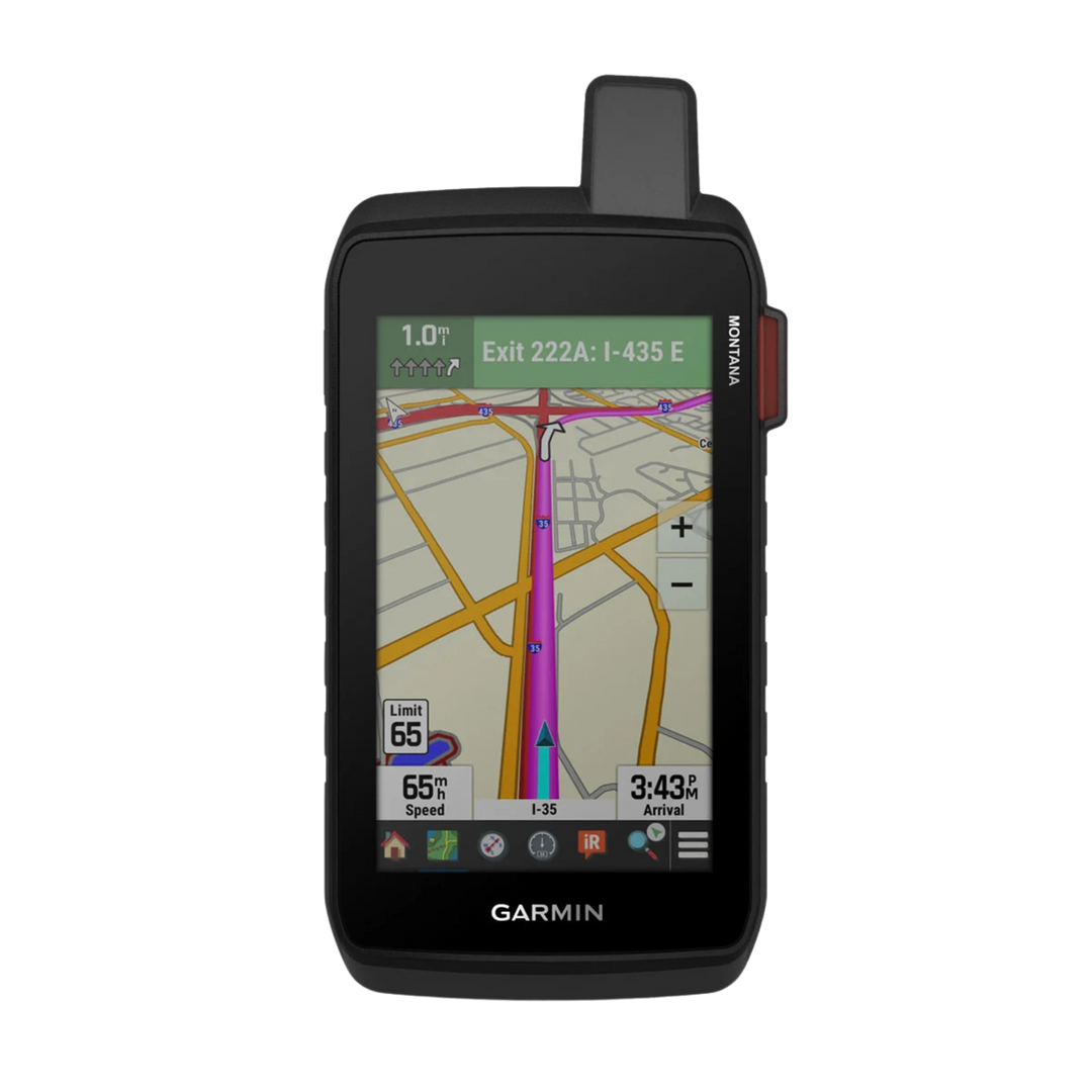


Garmin Montana® 710i Rugged GPS Touchscreen Navigator with inReach® Technology - Bundle
Garmin Montana® 710i Bundle with Free Accessories
Get the Garmin Montana® 710i with extra accessories included FREE, making it easier to power and protect your device at home, on the road and in the wild.
Free accessories included
- ✓ Screen Protector
- ✓ Wall Adapter
- ✓ Car Adapter
- ✓ Garmin charging/data cable
About this item
-
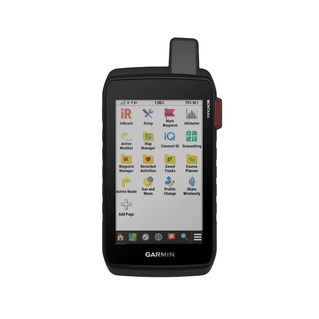
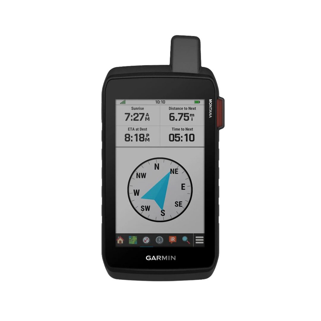
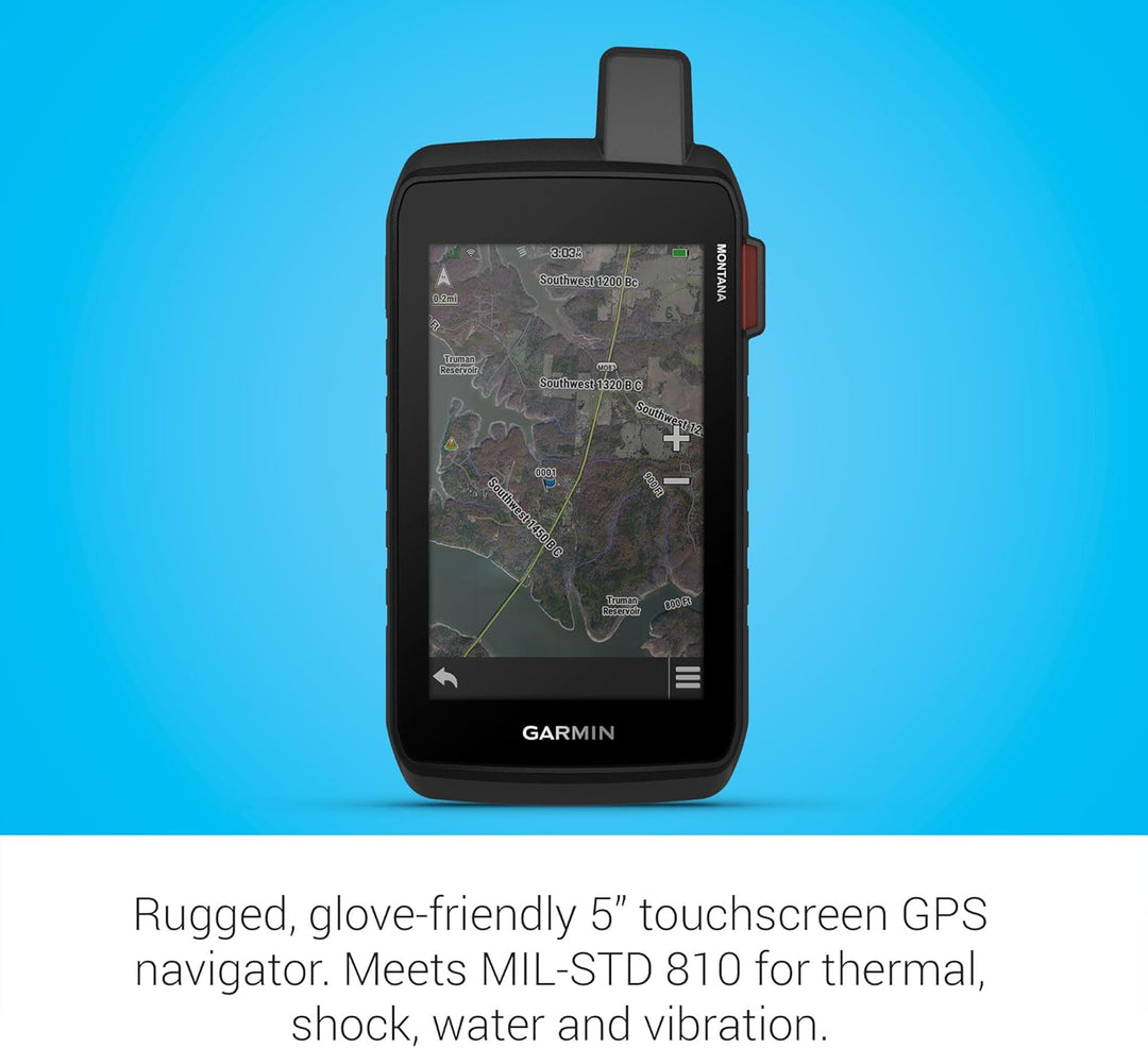
Large 5-inch glove-friendly touchscreen
-
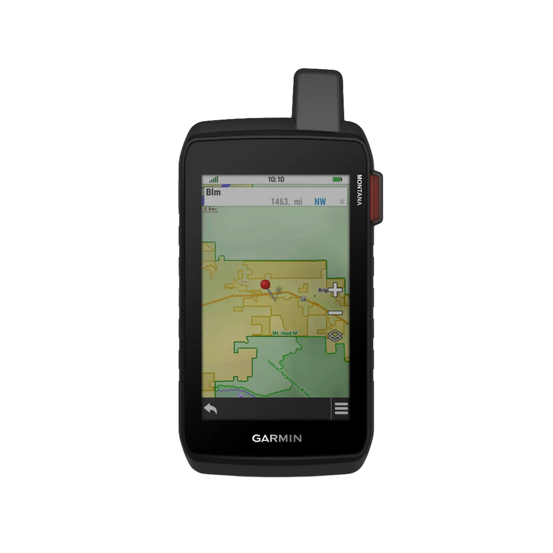
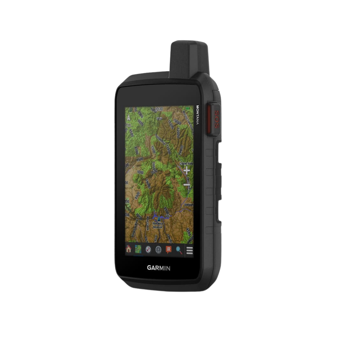
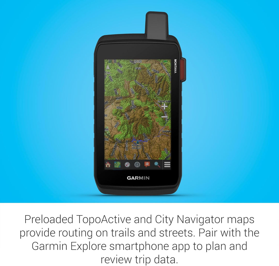
Routable topographic maps with landmarks
-
Preloaded City Navigator® North America maps for turn-by-turn road navigation
-
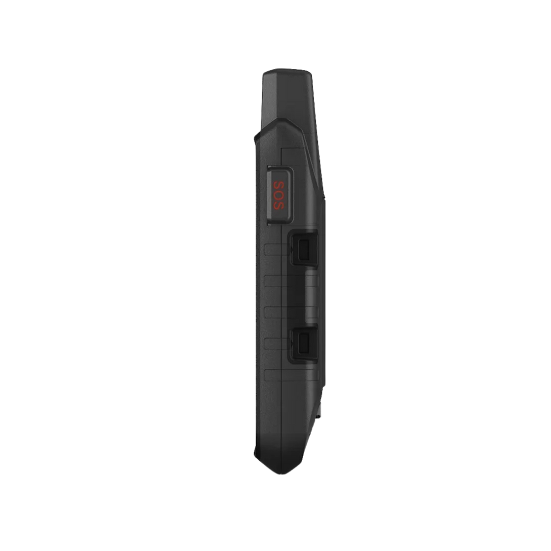
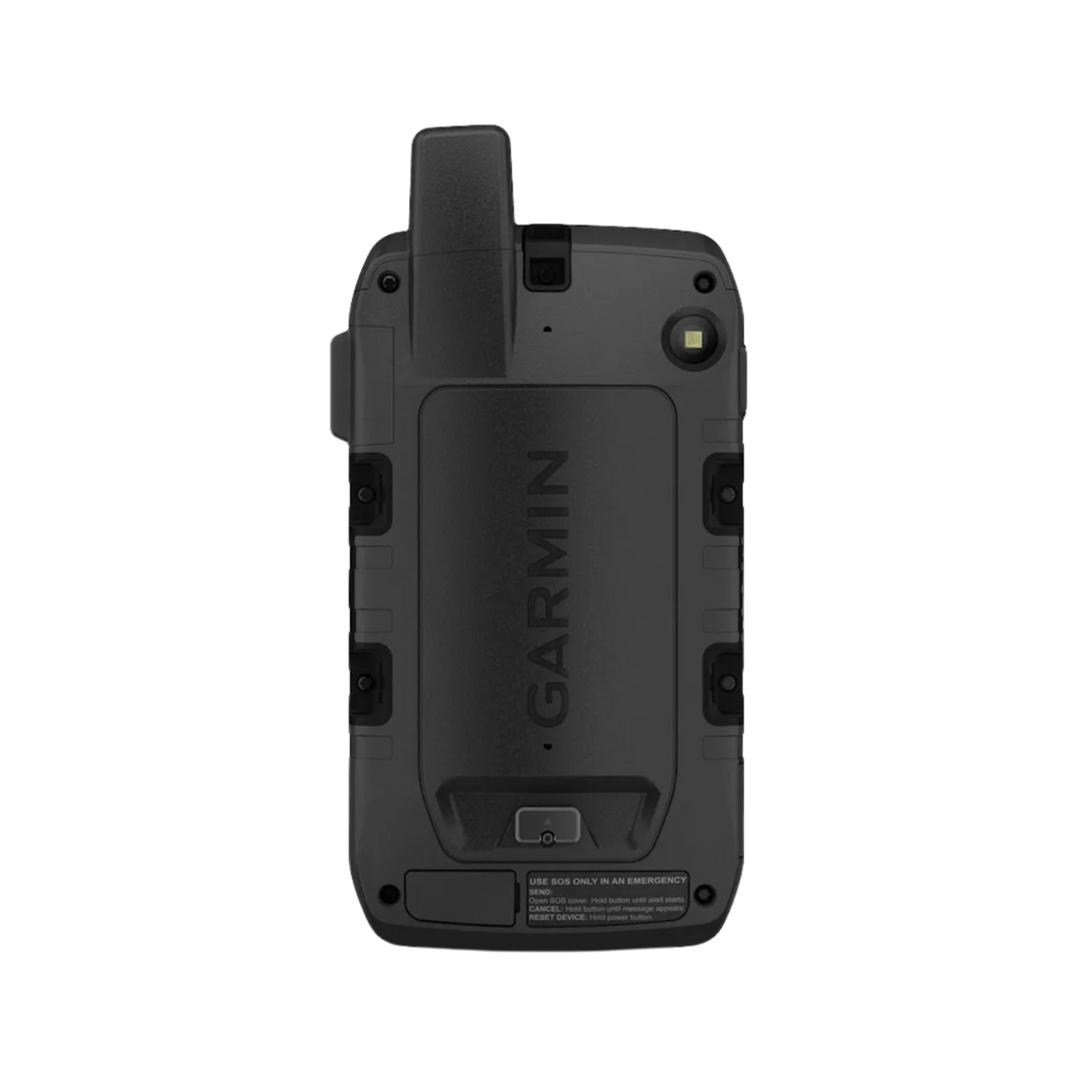
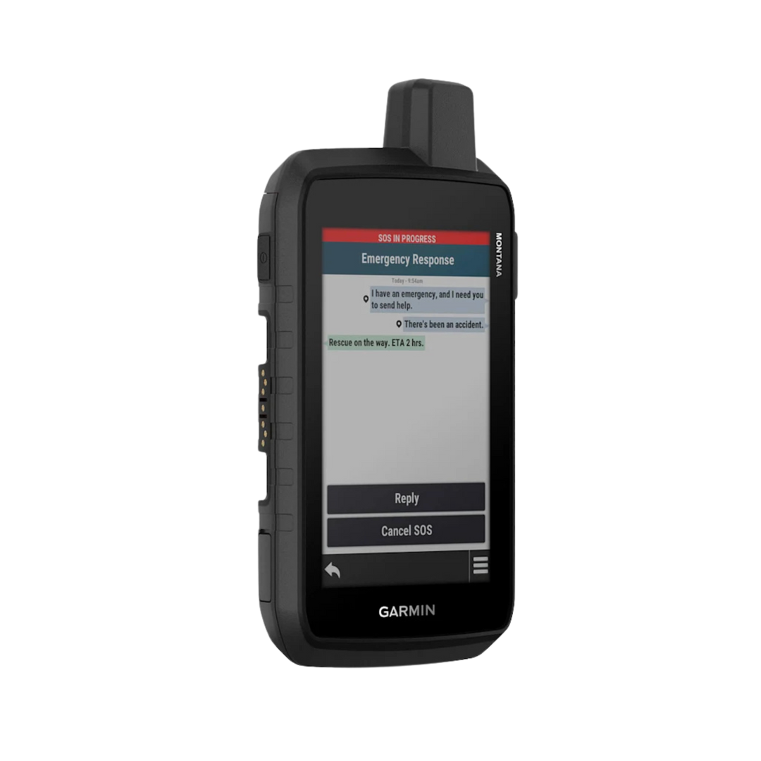
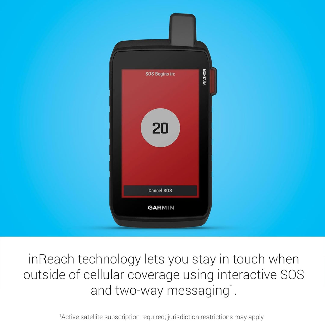
Trigger an interactive SOS with our 24/7 global coordination center
-
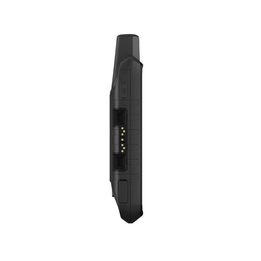
Meets MIL-STD 810 for thermal, shock, water, and vibration
-
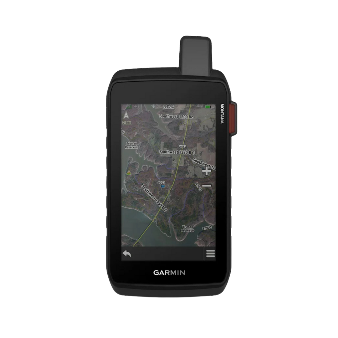
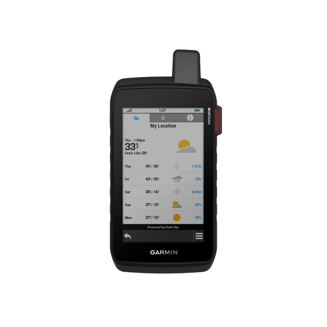
Satellite imagery shows vivid overhead views of your route
-
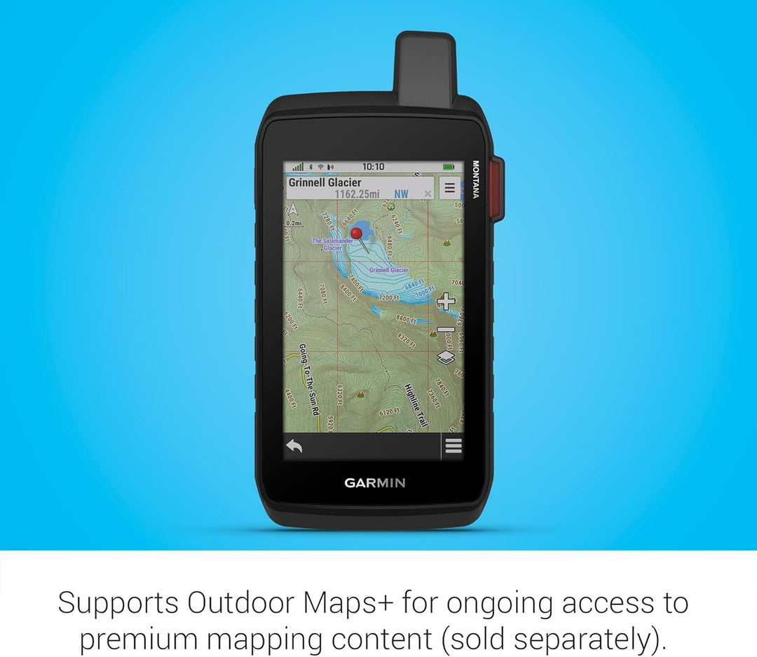
Supports Outdoor Maps+ for premium mapping (sold separately)
Product Description
The rugged Montana® 710i handheld GPS navigator with inReach® technology keeps you on track and in touch during all your adventures. Stay connected with inReach technology for two-way text messaging, live tracking, and SOS alerts, and store more maps with its 32 GB memory capacity. With high-resolution satellite imagery and multi-GNSS support, this device can handle any terrain. Enjoy longer battery life and easy recharge with a standard USB-C® cable. Plus, Montana 710i is built to withstand thermal, shock, and water damage.
WHAT YOU'LL LOVE

GLOBAL CONNECTIVITY
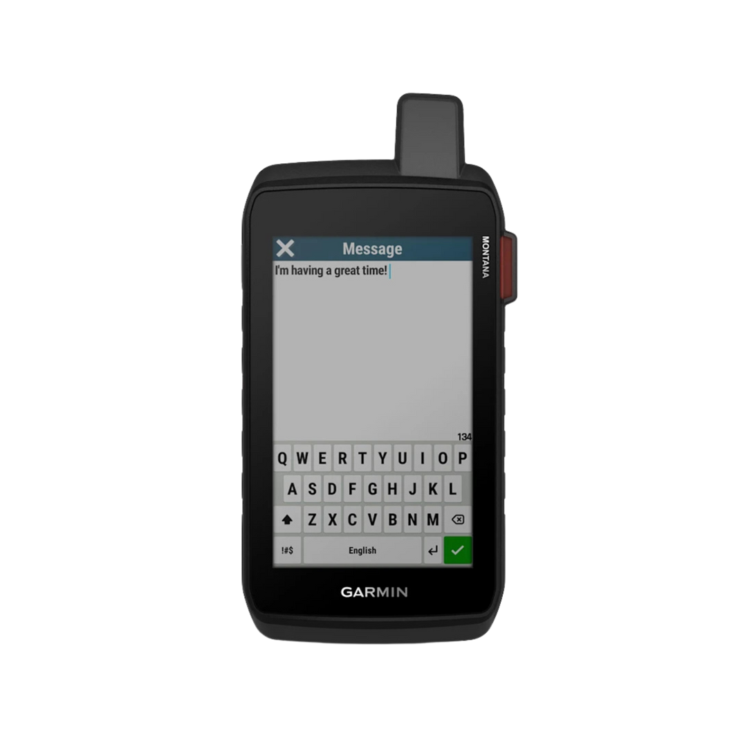
With an active inReach subscription, you can stay connected even when your adventures go off grid. Instead of relying on cellphone coverage, now your messages, SOS and tracking are transferred via the 100% global Iridium® satellite network1.

RUGGED BY DESIGN
This durable, water-resistant handheld is tested to meet MIL-STD 810 for thermal, shock, water and vibration. It features a glove-friendly 5-inch touchscreen and is compatible with a variety of robust mounting solutions (sold separately) to best suit your activities.

TOPOACTIVE + CITY NAVIGATOR MAPS
To navigate your adventures, use preloaded worldwide topographical maps. View terrain contours, elevations, coastlines, rivers, landmarks and more. Plus preloaded City Navigator® North America mapping for turn-by-turn road navigation, so you can transition seamlessly from trails to town.

SATELLITE VIEWS
Access subscription-free, high-resolution satellite imagery with direct-to-device downloads over Wi-Fi® connectivity. See photorealistic overhead views of routes and surrounding terrain, and easily create waypoints based on landmarks.

OUTDOOR MAPS+
Add a subscription to Outdoor Maps+ (sold separately), and get ongoing access to a wide variety of premium mapping content and regular updates sent right to your Garmin device via Wi-Fi technology.

GARMIN EXPLORE APP
Pair with the Garmin Explore™ app to plan and review trip data, plus manage your waypoints, courses and activities.
EXPLORE THE WORLD. STAY CONNECTED TO HOME.
In the Box
- Montana 710i
- Lithium-ion battery pack
- USB cable
- Documentation
- Screen Protector
- Wall Charger
- Car Charger
Case colors may vary.